| |
|
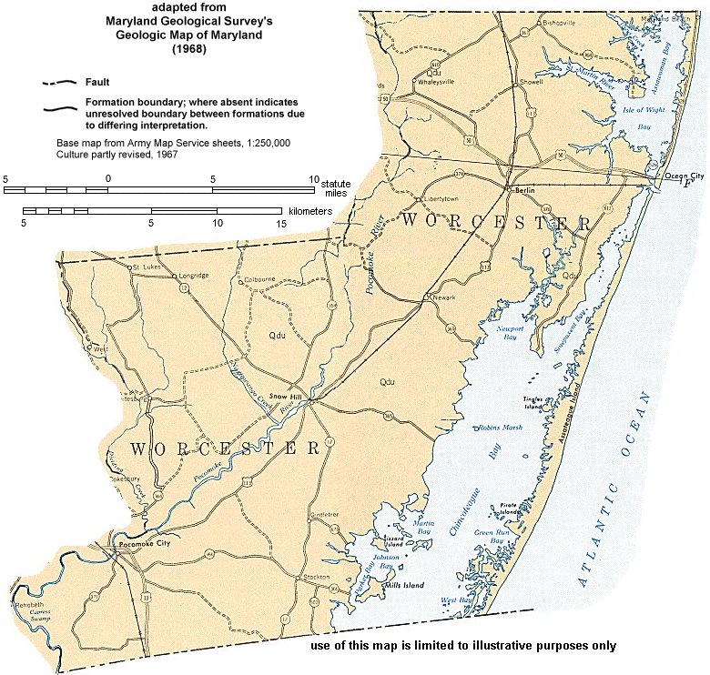
| Worcester County (1968) |
Caution: These images were scanned from a paper copy of the out-of-print and outdated 1968 Geologic Map of Maryland. Due to the age of this map, these images do not necessarily represent an accurate interpretation of currently accepted geologic theory. Because the projection of the original map was distorted during reproduction, and the paper medium is not stable, these images do not meet any cartographic standards. Therefore geographic or Cartesian coordinates cannot be applied to these images, and georeferencing is not possible.
These images are for illustration purposes only. Do not use these documents for GIS, navigation, legal purposes, surveying, or anything else other than document illustrations. They were created only to illustrate our publications and are not accurate enough to be used for any other purposes. You may use them as illustrations only, and you must give proper credit to Maryland Geological Survey when using these maps.
Newer geologic maps (1978) and topographic maps (1984) of Worcester County are available through our List of Publications.
| Legend Click on a tile to display information about the associated rock types or formations. |
Lowland Deposits Undifferentiated gray to buff sand and gravel, gray to brown lignitic silt and clay, occasional boulders, and rare shell beds. Surficial deposits occur as intercalated fluvial sands and marsh muds (e.g. in upstream floodplains of the Wicomico and Nanticoke Rivers), well sorted, stabilized sand dunes (e.g. eastern Wicomico County), shell-bearing estuarine clays and silts (e.g. lower Dorchester County and Pocomoke River basin of Worcester County), and beach zone sands (e.g. Fenwick and Assateague Islands). Wisconsin to Holocene in age. Subsurface deposits of pre-Wisconsin age consist of buff to reddish-brown sand and gravel locally incised into Miocene sediments (e.g. Salisbury area), estuarine to marine white to gray sands, and gray to blue, shell-bearing clays (e.g. Worcester County). |
|
 |
||
Use your browser's SAVE feature to save this map. Place your mouse over the map and click your RIGHT mouse button (or the Left button if you have set up your mouse as a left-handed mouse). A pop-up menu will appear. Select "Save image as.." (Netscape) or "Save picture as.." (IE) and type in a name for the map in the FILE NAME dialog box. Once saved, you can resize this image with your favorite graphics software.
Updated 6/5/00